
Our Services
Comprehensive subsurface utility detection and mapping services for construction, development, and infrastructure projects
Utility Locating & Mapping
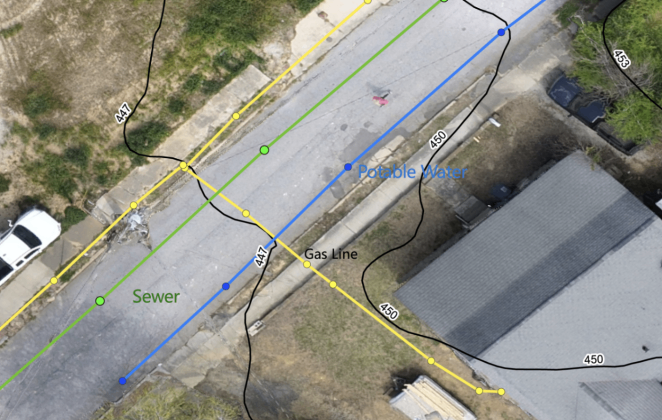
Accurate detection and documentation of underground utilities for any site. We locate both private and public utility lines — water, sewer, gas, electric, telecom, and fiber optic — and provide marked line documentation you can actually use.
Who it helps:
Contractors, developers, facility managers, and property owners who need to know what's underground before they dig.
The value:
Prevent costly utility strikes, reduce project delays, and get comprehensive mapping deliverables including PDF reports and KMZ files with every job.
- Ground Penetrating Radar (GPR)
- Electromagnetic Locating
- Private & Public Utility Detection
- Depth Measurements
- GPS Mapping & Documentation
- PDF & KMZ Deliverables Included
- Utility Overlay Maps Available
Orthomosaic Mapping
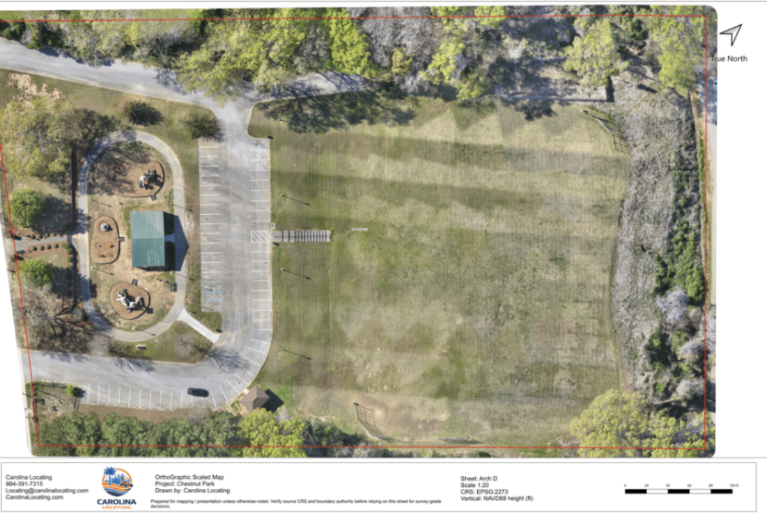
High-resolution, georeferenced aerial maps of your site stitched together into a single accurate image. Orthomosaic maps give you a precise, measurable top-down view of site conditions — ideal for construction planning, progress documentation, and property records.
Who it helps:
Contractors, engineers, developers, and property owners who need accurate site imagery for planning, documentation, or client deliverables.
The value:
Get a detailed, to-scale aerial map of your site that can be used in CAD, GIS, or project management platforms. Utility lines can be accurately marked directly on the orthomosaic.
- High-Resolution Georeferenced Imagery
- Full Site Coverage
- Measurable & Scalable Output
- Compatible with CAD & GIS Platforms
- Utility Line Overlay Available
- Construction Progress Documentation
- PDF & GeoTIFF Deliverables
Topographic Mapping
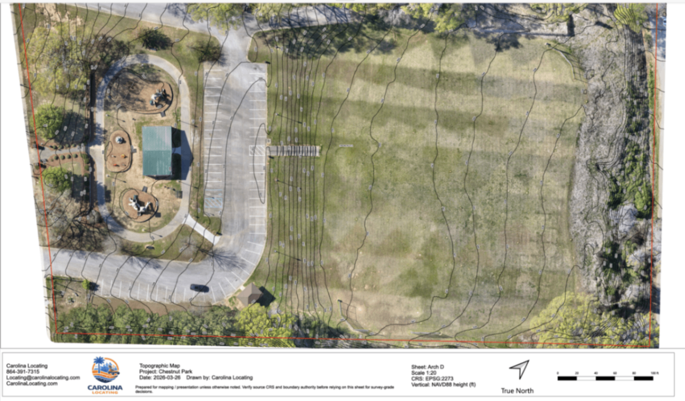
Accurate elevation data and contour mapping for your site. Topographic maps show the shape of the land — grades, slopes, drainage patterns, and elevation changes — giving your team the data needed for grading plans, drainage design, and site layout.
Who it helps:
Civil engineers, grading contractors, developers, and site planners who need accurate elevation data before construction begins.
The value:
Reduce design errors and rework by starting with accurate topographic data. Topo maps can be combined with utility locating data to show both surface and subsurface conditions in one deliverable.
- High-Accuracy Elevation Data
- Contour Line Generation
- Slope & Grade Analysis
- Drainage Pattern Identification
- Combined Utility & Topo Overlays
- Compatible with Civil Design Software
- PDF & DXF Deliverables
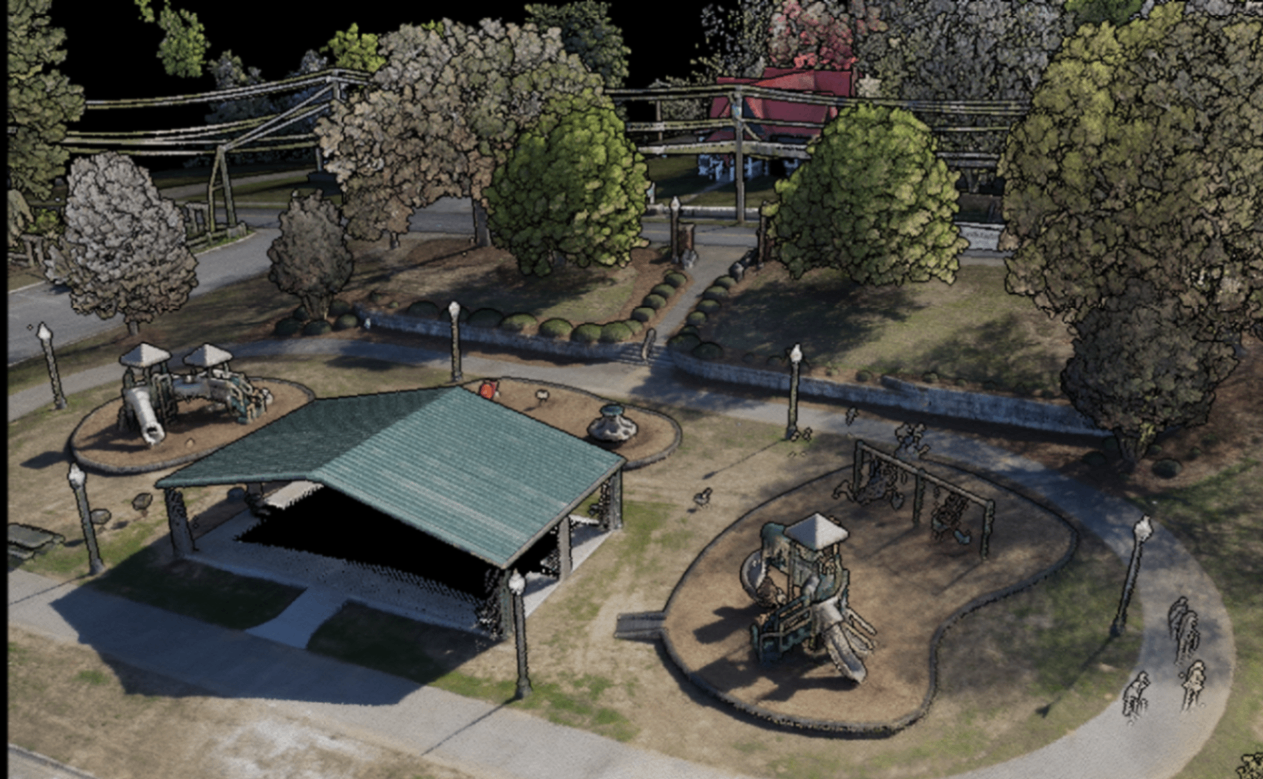
LiDAR Mapping & 3D Models
LiDAR (Light Detection and Ranging) captures millions of precise data points to create detailed 3D representations of your site. The result is an accurate 3D model of existing conditions — structures, terrain, vegetation, and more — that can be used for design, analysis, and documentation.
Who it helps:
Engineers, architects, construction managers, and facility teams who need detailed 3D site data for design coordination, clash detection, or as-built documentation.
The value:
Get a highly accurate 3D model of your site that reduces field visits, supports design decisions, and provides a permanent record of existing conditions before construction begins.
- High-Density LiDAR Point Cloud Data
- 3D Site Model Generation
- Terrain & Structure Capture
- As-Built Documentation
- Design Coordination Support
- Compatible with BIM & CAD Platforms
- LAS, LAZ & 3D Model Deliverables
Thermal Imagery
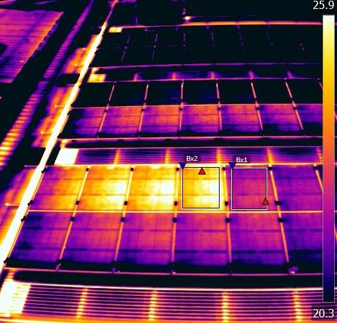
Thermal imaging captures heat signatures across your site or structure, revealing what the naked eye cannot see. We use thermal cameras to identify moisture intrusion, heat loss, subsurface anomalies, and potential problem areas before they become costly issues.
Who it helps:
Facility managers, building owners, roofing contractors, and engineers who need to identify hidden moisture, energy loss, or subsurface conditions without invasive investigation.
The value:
Catch problems early. Thermal imagery helps you identify moisture issues, insulation failures, and subsurface anomalies quickly and non-invasively — saving time and money on repairs.
- High-Resolution Thermal Imaging
- Moisture & Heat Loss Detection
- Roof & Building Envelope Inspection
- Subsurface Anomaly Identification
- Aerial Thermal Coverage Available
- Detailed Thermal Reports
- PDF & Image Deliverables
Video Pipe Inspection
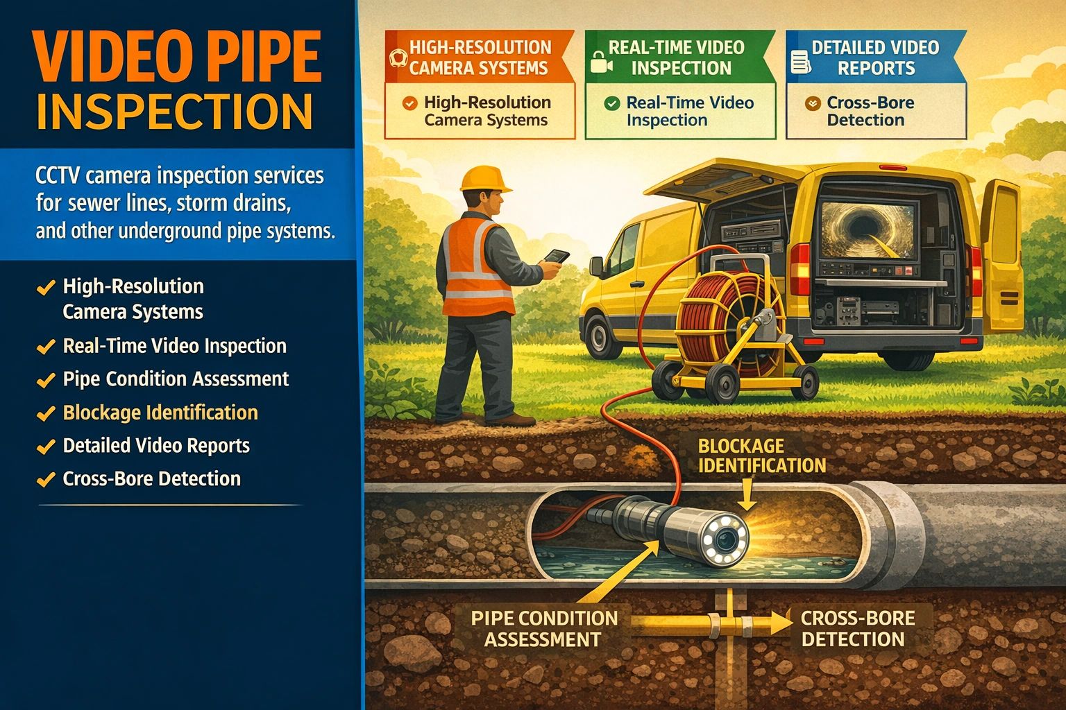
CCTV camera inspection of sewer lines, storm drains, and underground pipe systems. We send a high-resolution camera through your pipes to document condition, identify blockages, locate cross bores, and assess structural integrity — all without excavation.
Who it helps:
Property owners, municipalities, contractors, and facility managers who need to know the condition of underground pipe systems before buying, building, or repairing.
The value:
See exactly what's inside your pipes before you dig. Video inspection saves time and money by identifying problems accurately and providing documented evidence of pipe condition.
- High-Resolution CCTV Camera Systems
- Real-Time Video Inspection
- Pipe Condition Assessment
- Blockage & Root Intrusion Identification
- Cross-Bore Detection
- Detailed Video Reports
- Pipe Location & Depth Data
Ready to Get a Quote?
Contact us for utility locating, orthomosaic mapping, topographic mapping, LiDAR mapping, 3D models, thermal imagery, or video pipe inspection.